
09 March 2024

West Dulwich: Completed puzzle piece.

By Twitter lingo it'd be "Here, I fixed it for you." Though to me it's my own question as to why it's never been present, perhaps the mess of a Hail & Ride it has...
A map that has bothered me ever since I've seen it from a young age, one that omits the 322.
"Martell Road" stops for 322 is in the road map in the centre, as well as the roads it serves under Hail & Ride; Rosendale Road; Tritton Road; Vale Street; St Gothard Road; St Cloud Road; St Gothard Road.
From memory there aren't other examples as this, not that I've found, putting aside the notion of express routes that don't have stops in the area.
I couldn't manage to stay true to the 10/2009 date of the map and edit some of P13: Removing the unusual New Cross-bound Besson Street section which is now direct via Queens Road instead. Then, Crystal Palace Tavern and simply "Dulwich Park" as well as randomly adding in Night Tube symbols and Overground symbols ahead of the South London Line resurrection's extension.
Postscript note: Noticed the lack of "Morval Road" after 'Brixton Water Lane' nor the following "St Matthew's Estate" nor the following "Lambeth Town Hall" for 3/N3, then again in an update of this 2009 map I wish I had, omitted "Croxted Close" so...
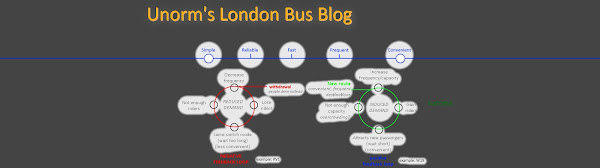
Interworking routes - taken to the next level

If you apply the Level 1 noob, Level 50 crook and Level 100 meme, you'll get something like this:
Level 1: Interwork route A and route B
Level 50: Interwork an entire mode with another mode
Level 100: Take level 1 to it's theoretical limit
Previously, Interworked iBus-display-ETM Though today I've delved into a similar topic, by explaining my madness in the image you've just seen in better detail, Interworked routes.
Fictional: A daily X68/SL6 that stops at Brixton and Elephant & Castle

A thought arisen from reading a suggestion on the bus forum.
Having X68 (SL6 from 31 July) stop at Brixton and Elephant & Castle. Perhaps also Kennington but I'd call into question 415's existence so for that purpose, I omitted that.
Besides, I have an idea to make extra use of 415's deckers by changing up my nemesis 322:

Every express route in London; past and present

At least ones which I can find, be it timetables and maps. I've tried my best in the months I've taken to form posts around it, draw multiple maps of which are mostly in my posts, draw out new ideas, and finishing it off with history.
Final promo for Expressa and Final promo for Expressa 2
Oh and the spreadsheet which won't make much sense without exposition through the posts.
An accurate depiction of London and dubious depiction of commercial ones - express and limited stop routes nonetheless.
Safe to say I'll take a break from maps after this.
Disclaimer: The word 'every' was used but it's a vast misrepresentation if we include the likes of National Express A-routes and whatnot, but that questions the line of bus and coach which I've no doubt blurred as I drew the map out.
Streatham High Road 1962 map (before Victoria Line)

Promo: Streatham High Road 1912-2022
After two years of drawing board I've finally completed this project.
1912 1942 1952 1962 1972 1982 1992 2002 2012 2023 all documented in map form.
Spreadsheet form for year-by-year detail where there is data (1934-2023).
Subscribe to:
Posts (Atom)
-
 I have done many a map edit of my favourite bus system, with a keen appreciation of the Tube Map which I've done one big edit of. Exhibi...
 -
 The 160's reroute via Sandhurst Road and 284's extension to Grove Park done to address 124's crowding and unreliability problems...
 -
 Inspired by Crossrail cutting straight through the city. The need for orbital rail around London, preferably further out than the current Ov...